
This weekend, residents from British Columbia to Manitoba face a complex “quad-threat” of extreme weather, including wildfire smoke, record heat, torrential rain, and localized flooding. Environment and Climate Change Canada issued multi-provincial alerts effective through Sunday, June 14, 2026, as a stagnant high-pressure ridge interacts with a moisture-heavy low-pressure system. This article explores the current Western Canada weather trends and provides essential safety strategies for navigating these volatile atmospheric conditions.
- Heat and smoke warnings are active for British Columbia and Alberta through Sunday.
- Saskatchewan and Manitoba face significant flood risks due to heavy rainfall.
- Health officials recommend limiting outdoor activity and using N95 masks for smoke protection.
The current meteorological situation reflects a broader pattern of climate variability seen across the Canadian West over the last decade. A persistent heat dome over the Pacific Northwest has pushed temperatures 10 to 15 degrees Celsius above seasonal norms in the interior of B.C. Meanwhile, a slow-moving cold front from the north is clashing with warm, humid air over the Prairies. This collision is triggering intense precipitation events that the parched soil cannot immediately absorb.
How is the 2026 weather pattern affecting Western Canada?
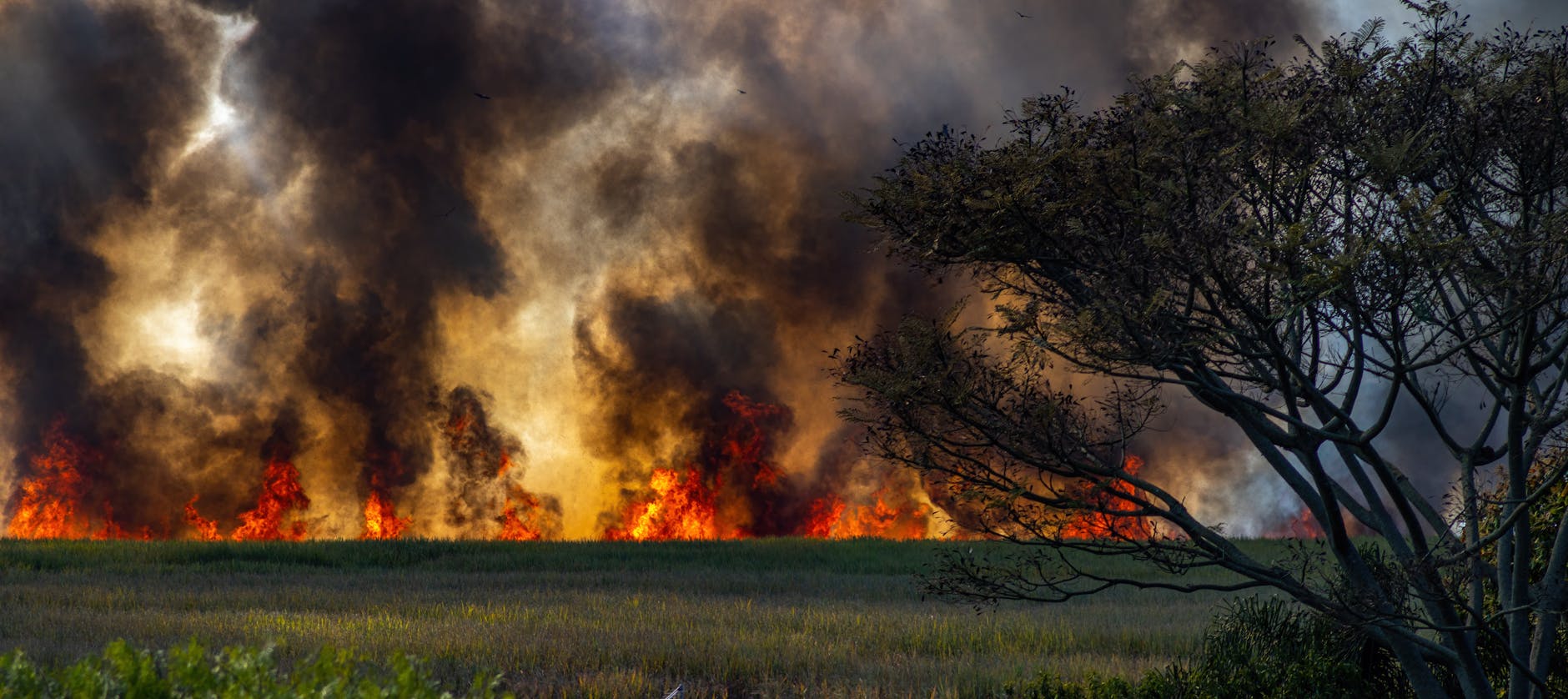
The dual presence of drought-induced wildfires and flash flooding presents a unique challenge for emergency management teams. In British Columbia, the Okanagan and Peace River regions are currently battling several out-of-control blazes. These fires are generating massive plumes of particulate matter that have drifted eastward, settling over major urban centres like Calgary and Edmonton. Air quality ratings have plummeted to “High Risk” levels, impacting visibility and respiratory health.
Further east, the situation shifts from fire to water. In Manitoba, specifically the Red River Valley, meteorologists have recorded over 75 millimetres of rain in less than 24 hours. This sudden influx has overwhelmed local drainage systems and raised river levels to near-bankfull capacity. The rapid transition from dry conditions to saturation increases the likelihood of overland flooding, which can damage property and disrupt agricultural operations.
Infrastructure resilience is being tested as highways face closures from both ends of the spectrum. In B.C., smoke has reduced visibility on the Coquihalla Highway, while in Manitoba, standing water has made several secondary roads impassable. Local authorities are urging motorists to check road reports before embarking on interprovincial travel this weekend.
What are the health risks of combined heat and smoke?
The combination of high ambient temperatures and poor air quality creates a hazardous environment for vulnerable populations. When the body is stressed by heat, the respiratory system must work harder, which exacerbates the effects of inhaling fine particulate matter (PM2.5). Health Canada notes that these particles can penetrate deep into the lungs and even enter the bloodstream, causing systemic inflammation.
“The synergy between extreme heat and wildfire smoke creates a cumulative physiological stressor that is far more dangerous than either event occurring in isolation.”
Medical professionals advise residents to seek air-conditioned environments and use high-efficiency particulate air (HEPA) filters indoors. For those who must work outside, frequent breaks and increased hydration are mandatory. It is also critical to monitor the official weather warnings from Environment and Climate Change Canada to receive real-time updates on changing air quality health index (AQHI) levels.
Why are flooding and heavy rain occurring simultaneously?
The simultaneous occurrence of these weather extremes is often driven by a “blocked” atmospheric pattern. In 2026, a high-pressure system over the West Coast has become stationary, acting as a wall that prevents weather systems from moving normally. This forces moisture-laden air to circulate around the high-pressure zone and dump heavy rain repeatedly over the same areas in Saskatchewan and Manitoba.
Data from the latest climate models suggest that these “blocking events” are becoming more frequent and intense. Soil that has been hardened by previous dry spells acts like concrete, causing rainwater to run off into basins rather than soaking into the ground. This phenomenon, known as “hydrophobic soil,” is a primary driver of the flash floods currently being observed in the eastern Prairies.
Municipalities are responding by deploying temporary flood barriers and clearing storm drains. However, the sheer volume of water predicted for the next 48 hours may exceed the design capacity of older infrastructure. Residents in low-lying areas are encouraged to move valuables to higher ground and ensure sump pumps are in working order.
How can residents prepare for rapid weather shifts?
Preparation begins with situational awareness and a flexible plan. Because conditions can shift from clear skies to thick smoke or heavy rain within hours, having a “go-bag” ready is a standard recommendation for 2026. This bag should include essential medications, N95 masks, bottled water, and a battery-powered radio to stay informed during potential power outages caused by lightning or heat-related grid strain.
Farmers and ranchers in the Prairies are also taking precautions by moving livestock away from flood-prone coulees. In the mountain regions, hikers are being warned to stay off trails where smoke might obscure landmarks or where heat exhaustion could lead to medical emergencies in remote areas. Community centres in many Western Canadian towns have been converted into “cooling and clean air hubs” to support those without home filtration or air conditioning.
Staying ahead of these environmental challenges requires a proactive approach to safety. By monitoring local forecasts and understanding the specific risks associated with heat, smoke, and water, residents can mitigate the impact of this volatile weekend. Prioritize health by staying indoors when air quality is poor and remain vigilant near rising water levels to ensure safety throughout the duration of these weather alerts.